Strait of Malacca
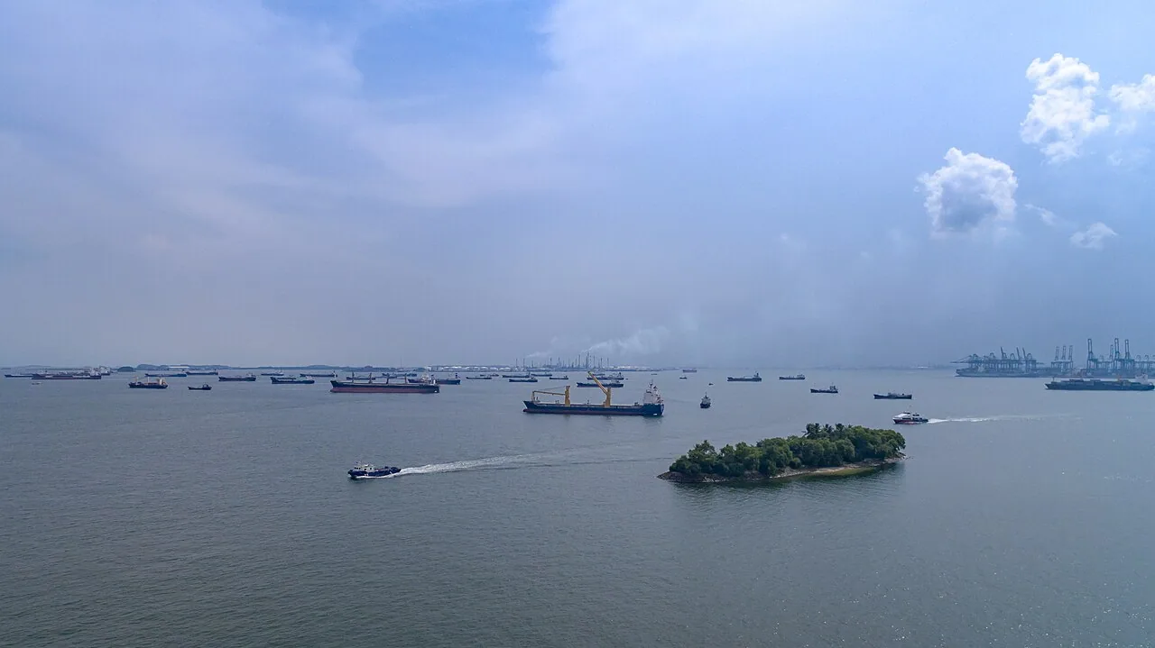
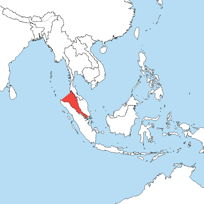
The Strait of Malacca is a narrow waterway running 900 kilometres in length and between 65 and 250 kilometres in width, situated between the Malay Peninsula to the northeast and the Indonesian island of Sumatra to the southwest. It connects the Andaman Sea, an arm of the Indian Ocean, with the South China Sea, an arm of the Pacific Ocean, and has functioned as the primary shipping corridor between those two oceans since at least the 17th century.
As of 2008, more than 94,000 vessels transited the strait annually, making it the busiest strait on earth. Those movements account for roughly 25% of all goods traded worldwide by volume, and as of 2024 the strait handles more than 35% of all oil transported by sea and 20% of global seaborne gas flows.
| Type | International maritime strait and shipping lane |
| Length | 900 km (560 miles) |
| Width (range) | 65 to 250 km (40 to 155 miles) |
| Narrowest navigable point | 2.8 km (1.5 nautical miles) at the Phillip Channel, near southern Singapore |
| Annual vessel transits (2008) | Over 94,000 |
| Share of world traded goods | Approximately 25% |
| Seaborne oil transit share (2024) | Over 35% |
| Seaborne gas transit share (2024) | Approximately 20% |
| Oil volume (2007) | Estimated 13.7 million barrels per day |
| Oil volume (2011) | Estimated 15.2 million barrels per day |
| Bordering territories | Malaysia and Thailand (northeast); Indonesia / Sumatra (southwest); Singapore (southeastern end) |
| IHO western limit | Line from Pedropunt, northern Sumatra (5°40′N 95°26′E) to Phromthep Cape, Phuket, Thailand (7°45′N 98°18′E) |
Geography and extent
The strait stretches 900 kilometres between the southwestern coast of the Malay Peninsula and the northeastern coast of Sumatra, with its width varying considerably along that length, from as little as 65 kilometres to as much as 250 kilometres. The International Hydrographic Organization defines its western limit as a line drawn from Pedropunt, the northernmost point of Sumatra at 5°40′N 95°26′E, to Phromthep Cape on Phuket Island in Thailand at 7°45′N 98°18′E.
The IHO places the eastern limit at a line connecting Tanjong Piai, the southernmost point of the Malay Peninsula at 1°16′N 103°31′E, through The Brothers to Klein Karimoen at 1°10′N 103°23.5′E. The northern boundary follows the southwestern coast of the Malay Peninsula, while the southern boundary traces the northeastern Sumatran coast as far east as Tanjong Kedabu at 1°06′N 102°58′E and then runs to Klein Karimoen.
At its most critical navigational constriction, the Phillip Channel near southern Singapore, the navigable waterway narrows to just 2.8 kilometres, equivalent to 1.5 nautical miles. The draughts of the world's largest oil tankers in some cases exceed the minimum depths available within this constriction, imposing practical limits on the vessel sizes that can transit fully laden.
Etymology and naming
The name Malacca derives from the Malay toponym Melaka, which was the name of the city that became the capital of the Malacca Sultanate. Historical tradition holds that the sultanate's founder, Parameswara, a Sumatran prince, named his new settlement after the Malacca tree, also known as the Indian gooseberry tree (Phyllanthus emblica), beneath which he had rested when selecting the site.
Over subsequent centuries the place name expanded beyond the city itself to encompass the strategically significant waterway separating the Malay Peninsula from Sumatra, and that usage has persisted in international geographic and maritime nomenclature to the present day.
How did trade routes develop through the strait before it became the main channel?
Before the strait itself was adopted as the principal through-route, early traders from Arabia, Africa, India and Persia made use of overland portage across the Malay Peninsula. Ships would call at Kedah, a western port on the peninsula, arriving via the monsoon winds between June and November and departing between December and May. Kedah provided the infrastructure for this transit trade, supplying accommodations, porters, small vessels, bamboo rafts and elephants, and collecting taxes on goods moved overland toward eastern ports including Langkasuka and Kelantan. Cargo traded at that time included glassware, camphor, cotton goods, brocades, ivory, sandalwood, perfume and precious stones.
Kedah and the kingdom of Funan were the dominant ports of this network through the 6th century. After the tenth century, Chinese vessels began calling at the eastern trading posts of the peninsula, gradually shifting the balance of traffic. It was only after that period that ships began to navigate the strait itself as a direct maritime corridor rather than relying on the overland crossing of the peninsula.
Historical control and strategic significance
The Strait of Malacca emerged as a contested strategic asset as early as the 7th century, when the maritime empire of Srivijaya, based at Palembang in Sumatra, extended its authority across the Malay Peninsula and toward Java. Srivijaya secured control of both the Strait of Malacca and the Sunda Strait, the two principal choke points of maritime Southeast Asia, by conducting a systematic series of conquests and raids against rival ports on either side of the waterway. That dominance persisted for approximately 700 years, during which Srivijaya derived substantial revenue from the spice trade, tributary arrangements with China, and commerce with Indian and Arab merchants.
Later polities continued to exercise power over the strait in succession: the Malacca Sultanate from the 15th century onward, followed by the Johor Sultanate, then the British colonial administration through the Straits Settlements, and in the modern era the city-state of Singapore. Since the 17th century the strait has served without interruption as the primary shipping corridor between the Indian Ocean and the Pacific Ocean, and control over its approaches has remained a central objective of regional and global maritime strategy.
What goods and commodities pass through the Strait of Malacca?
The cargo carried through the strait encompasses the principal commodities of global trade. Oil is the dominant flow by value and strategic importance: in 2007 an estimated 13.7 million barrels per day moved through the waterway, a figure that grew to approximately 15.2 million barrels per day by 2011. By 2024, the strait accounted for more than 35% of all oil transported by sea and around 20% of global seaborne gas flows.
Beyond hydrocarbons, the strait serves as the main conduit for Chinese manufactured products moving toward Indian Ocean markets and beyond, as well as for coal, palm oil and Indonesian coffee moving in various directions. In aggregate, the approximately 94,000 annual vessel transits recorded in 2008 represented roughly 25% of all goods traded globally.
Role in the Maritime Silk Road
The strait forms a critical segment of the contemporary Maritime Silk Road, the sea-based trade corridor that links the Chinese coast southward to the tip of India, then westward to Mombasa on the East African coast. From Mombasa the route continues through the Red Sea and the Suez Canal into the Mediterranean, and ultimately to the northern Adriatic port of Trieste in Italy, where rail connections distribute cargo onward to Central Europe and the North Sea hinterland.
The Strait of Malacca therefore acts as the Pacific gateway of this extended corridor, connecting the major Asian economies of China, Japan, South Korea, Taiwan, the Philippines, Vietnam, Thailand, Malaysia, Indonesia, Singapore and India to the westward-reaching segments of the route.
Congestion and navigational constraints
The combination of extreme traffic density and limited navigable width makes the Strait of Malacca one of the most congested maritime choke points in the world. At its narrowest navigable section, the Phillip Channel near southern Singapore, the passable corridor is only 2.8 kilometres wide. This physical constraint means that vessels with deep draughts, particularly the largest crude oil tankers, cannot always transit at full load.
The volume of traffic generates persistent challenges relating to vessel separation, collision risk and the management of overtaking and crossing movements within confined waters. These operational pressures are compounded by the navigational complexity introduced by the varying widths of the strait along its 900-kilometre length.
Piracy and smuggling
The high density of commercial traffic transiting the strait has made it an environment in which modern piracy and smuggling operations present a continuing concern for vessel operators, insurers and regional authorities. The strait's combination of heavy traffic, constrained navigation and proximity to numerous small islands and coastal settlements creates conditions that have historically been exploited by those engaged in maritime crime.
The economic significance of the goods in transit, ranging from crude oil and liquid natural gas to manufactured products and agricultural commodities, heightens the consequences of any disruption, whether from criminal activity or other causes.
Frequently asked questions
How long and wide is the Strait of Malacca?
The strait is 900 kilometres (560 miles) long. Its width varies considerably along that length, ranging from 65 kilometres at its narrowest to 250 kilometres at its widest. At the Phillip Channel near southern Singapore, the navigable passage narrows further to just 2.8 kilometres.
How many ships pass through the Strait of Malacca each year?
As of 2008, the strait recorded more than 94,000 vessel transits per year, making it the busiest strait in the world by that measure. That volume of traffic corresponds to approximately 25% of all goods traded globally passing through the waterway.
What percentage of the world's oil passes through the Strait of Malacca?
As of 2024, more than 35% of all oil transported by sea flows through the strait, along with approximately 20% of global seaborne gas. In volume terms, oil flows grew from an estimated 13.7 million barrels per day in 2007 to approximately 15.2 million barrels per day in 2011.
Which oceans does the Strait of Malacca connect?
The strait connects the Andaman Sea, which is part of the Indian Ocean, with the South China Sea, which is part of the Pacific Ocean. It has served as the principal maritime corridor between those two ocean systems since at least the 17th century.
Why is the Strait of Malacca named after Malacca?
The name derives from the city of Malacca, capital of the Malacca Sultanate. Historical tradition records that the sultanate's founder, Parameswara, named the settlement after the Malacca tree (Phyllanthus emblica), also known as the Indian gooseberry tree, under which he rested when choosing the site. The name subsequently extended from the city to the adjacent waterway.
Which empire first controlled the Strait of Malacca?
The maritime empire of Srivijaya, based at Palembang in Sumatra, was the first major power to exercise deliberate control over the strait, doing so from the 7th century onward. By conquering potential rival ports on both sides of the waterway and also controlling the Sunda Strait, Srivijaya maintained economic and military dominance over the region for approximately 700 years.
What commodities other than oil are transported through the strait?
In addition to crude oil and gas, the strait carries Chinese manufactured goods, coal, palm oil and Indonesian coffee, among other commodities. These flows collectively represent roughly 25% of the world's traded goods by volume.
Where does the Strait of Malacca fit within the Maritime Silk Road?
The strait forms the Pacific entry point of the Maritime Silk Road, the extended sea corridor linking the Chinese coast through Southeast Asia and across the Indian Ocean to Mombasa, then through the Red Sea, the Suez Canal and the Mediterranean to the port of Trieste in northern Italy. From Trieste, rail connections carry cargo to Central Europe and the North Sea region.
Sources
- Wikipedia: Strait of Malacca — Factual basis of this entry