Strait of Gibraltar
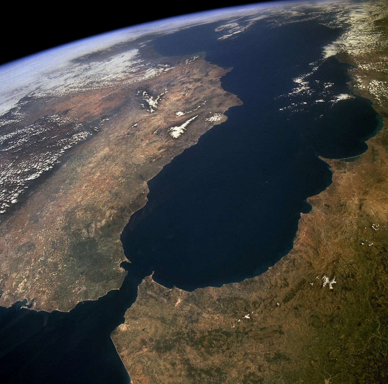
The Strait of Gibraltar is a navigable strait connecting the Atlantic Ocean to the Mediterranean Sea while simultaneously forming the boundary between Europe to the north and Africa to the south. Its shores fall within the territorial waters of Spain, Morocco, and the British overseas territory of Gibraltar, with Ceuta, a Spanish autonomous city on the African coast, also fronting the passage. Under the United Nations Convention on the Law of the Sea, all foreign vessels and aircraft retain the right of continuous transit passage through the strait.
At its narrowest point the two continents are separated by just 7.7 nautical miles (14.3 km), a distance short enough for ferry services to complete a crossing in as little as 35 minutes. The strait's depth ranges between 300 and 900 metres, a profile that accommodates deep-draught ocean-going vessels and permits the layered two-way water exchange between the Atlantic and the Mediterranean.
| Type | International strait connecting Atlantic Ocean and Mediterranean Sea |
| Narrowest width | 7.7 nautical miles (14.3 km; 8.9 mi) |
| Depth range | 300–900 metres (980–2,950 ft) |
| Depth at Camarinal Sill | 280 m (920 ft) |
| Depth at narrows | 900 m (3,000 ft) |
| Minimum ferry crossing time | 35 minutes |
| Bordering jurisdictions | Spain, Morocco, Gibraltar (UK), Ceuta (Spain) |
| Transit rights framework | United Nations Convention on the Law of the Sea |
| Naval abbreviation | STROG (STRait Of Gibraltar) |
| Important Bird Area status | Designated by BirdLife International |
What is the Strait of Gibraltar and where does it lie?
The Strait of Gibraltar, sometimes rendered as the Straits of Gibraltar, sits at the western end of the Mediterranean Sea where it meets the North Atlantic Ocean. The northern shore is shared by mainland Spain and Gibraltar, a British overseas territory on the southern tip of the Iberian Peninsula, while the southern shore is divided between Morocco and Ceuta, the latter being a Spanish autonomous city on African soil.
The strait is also referred to in naval usage as the STROG, an acronym for STRait Of Gibraltar. Older English texts sometimes used the name 'Gut of Gibraltar', though that form is now largely archaic. In Latin antiquity the passage was called Fretum Gaditanum, the Strait of Cádiz, and also Fretum Herculeum, a name derived from the classical designation 'Pillars of Hercules', which referred to the mountains flanking the entrance as colossal natural pillars.
Names and etymology
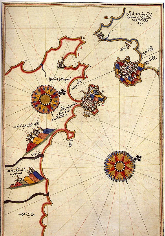
The modern English name traces directly to the Rock of Gibraltar, whose own name derives from the Arabic Jabal Ṭāriq, meaning 'Tariq's Mount', a reference to the Umayyad commander Tariq ibn Ziyad. A second Arabic name, Bāb al-maghrib, translates as 'Gate of the West', 'Gate of the Sunset', or more geographically as 'Gate of the Maghreb' or 'Gate of Morocco'.
During the medieval period Arabic-speaking geographers called the passage Az-Zuqāq, meaning 'the Passage', and sometimes expanded it to Bḥar az-zuqāq, 'the passage sea'. The ancient Greek tradition knew the flanking promontories collectively as the Pillars of Hercules, a name the Romans then incorporated into their Latin designation Fretum Herculeum.
Physical dimensions and depth
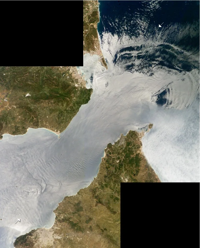
The narrowest section of the strait measures 7.7 nautical miles, equivalent to 14.3 kilometres or 8.9 miles. This constriction is the controlling dimension for traffic management and influences the intensity of tidal and current flows through the passage.
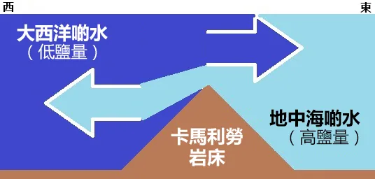
Water depths across the strait vary considerably, ranging from 300 to 900 metres (980 to 2,950 feet, or 160 to 490 fathoms). The shallowest significant feature is the Camarinal Sill, which rises to approximately 280 metres (920 feet), while the deepest sections near the narrows reach approximately 900 metres (3,000 feet). These depth differences are linked directly to the erosive force of the Zanclean flood some 5.33 million years ago, when Atlantic waters broke through and carved the present form of the passage.
Transit rights and international law
Because the strait falls within the territorial waters of Morocco, Spain, and Gibraltar, freedom of navigation cannot be assumed under ordinary baseline rules. The United Nations Convention on the Law of the Sea resolves this by guaranteeing foreign vessels and aircraft the right of continuous transit passage, meaning they may cross without prior permission provided the passage is non-stop and expeditious.
This legal regime is of direct practical importance to global freight flows, since the strait is the sole maritime connection between the Atlantic Ocean and the Mediterranean Sea. Any vessel or aircraft engaged in continuous transit passage through the strait exercises that right regardless of the flag it carries.
Ferry and passenger crossings
The short distance between the European and African shores makes the strait a practical corridor for passenger and vehicle ferries operating daily between the two continents. Under favourable conditions a crossing can be completed in as little as 35 minutes, reflecting how close the two coastlines are at the narrowest point.
The same geographic proximity that facilitates legal crossings also makes the strait a frequent route for illegal migration from Africa into Europe, a pattern that is a direct consequence of its position as the nearest sea gap between the two continents.
Geology and the Zanclean flood
The seabed of the strait is underlain by synorogenic Betic-Rif clayey flysch, overlaid by Pliocene and Quaternary calcareous sediments produced by cold-water coral communities. Exposed bedrock surfaces, coarse sediments, and localised sand dunes testify to the strong bottom-current conditions that persist today.
Approximately 5.97 million years ago the Atlantic-Mediterranean connection along what were then called the Betic and Rifan Corridors was progressively cut off until it closed entirely. This isolation triggered the Messinian salinity crisis, during which the Mediterranean's salinity rose to levels that caused the periodic deposition of gypsum and salt layers across the basin floor over a span of roughly 640,000 years. The massive salt and mineral deposits found beneath the Mediterranean seabed today are a direct legacy of that era.
About 5.33 million years ago Atlantic waters broke through the Strait of Gibraltar in an event known as the Zanclean flood, fully re-establishing the ocean-to-sea connection that has remained open ever since. The erosive power of that inundation is considered the primary cause of the strait's present depth of 900 metres at the narrows. Plate tectonics will eventually close the strait again as the African Plate continues its northward movement relative to the Eurasian Plate, though this will occur on geological rather than human timescales.
Biodiversity and wildlife
BirdLife International has designated the Strait of Gibraltar as an Important Bird Area on account of the hundreds of thousands of seabirds that use it annually as a migration corridor between the Mediterranean and the Atlantic. Species recorded in significant numbers include Scopoli's and Balearic shearwaters, Audouin's and lesser black-backed gulls, razorbills, and Atlantic puffins.
A resident pod of approximately 36 orca inhabits the waters around the strait, constituting one of the few remaining orca populations in Western European waters. Long-term exposure to polychlorinated biphenyl (PCB) pollution poses a serious threat to the pod's survival, and its extinction within the coming decades has been identified as a possibility.
Historical role in navigation and migration
Human presence near the strait extends far into prehistory: Neanderthals inhabited the area as long as 125,000 years ago, with evidence suggesting the Rock of Gibraltar may have been among the last Neanderthal refuges in the world, occupied as recently as 24,000 years ago. Anatomically modern Homo sapiens reached the area approximately 40,000 years ago.
Throughout recorded history the relatively short crossing made the strait a preferred transit point for successive civilisations and military forces. Carthaginian forces used it to campaign against Rome; Roman administrators crossed between the provinces of Hispania and Mauritania; Vandal raiding parties passed southward in the fifth century on their way from Germania through Western Rome into North Africa; and Moorish and Berber forces crossed during the eighth to eleventh centuries. Spanish and Portuguese maritime activity in the sixteenth century made the passage a critical gateway to Atlantic trade routes.
From 1492 onward the strait took on an additional function as a cultural and political boundary. In that year the last Muslim government on the northern side of the passage was overthrown by Spanish forces, transforming the strait into a more pronounced divide between the civilisational zones on either shore.
Frequently asked questions
How wide is the Strait of Gibraltar at its narrowest point?
The strait narrows to a minimum of 7.7 nautical miles, equal to 14.3 kilometres or 8.9 miles. This is the controlling width for vessel traffic and the point at which the European and African coastlines are closest to each other.
How long does the ferry crossing take?
Ferry services connecting the two continents across the strait can complete the voyage in as little as 35 minutes under favourable conditions. Services operate daily, taking advantage of the short distance between the European and African shores.
Do ships have the right to pass through the Strait of Gibraltar freely?
Yes. Under the United Nations Convention on the Law of the Sea, foreign vessels and aircraft have the right of continuous transit passage through the strait. This applies regardless of the flag carried, provided the passage is continuous and without interruption. The strait falls within the territorial waters of Spain, Morocco, and Gibraltar, so this international legal framework is essential to guaranteeing unrestricted navigation.
How deep is the Strait of Gibraltar?
Depths across the strait range from 300 to 900 metres (980 to 2,950 feet). The Camarinal Sill, the shallowest significant feature, rises to around 280 metres, while the deepest sections near the narrows reach approximately 900 metres. These variations are largely the result of erosion during the Zanclean flood some 5.33 million years ago.
What caused the Strait of Gibraltar to form geologically?
The strait in its current form results from the Zanclean flood, which occurred approximately 5.33 million years ago when Atlantic waters broke through and re-established the connection with the Mediterranean. Prior to that event, the sea had been cut off from the Atlantic for a geologically significant period, triggering the Messinian salinity crisis and the deposition of vast salt and mineral layers across the Mediterranean basin. The erosive force of the floodwaters is considered the main reason the strait reaches depths of up to 900 metres today.
Which countries control the shores of the Strait of Gibraltar?
The northern shore is administered by Spain and by Gibraltar, a British overseas territory situated on the southern tip of the Iberian Peninsula. The southern shore is divided between Morocco and Ceuta, a Spanish autonomous city located on African soil. The strait therefore falls within the territorial waters of three distinct administrations: Spain, Morocco, and Gibraltar.
What wildlife is found in and around the Strait of Gibraltar?
The strait supports a resident orca pod of around 36 individuals, one of the few remaining such groups in Western European waters; long-term PCB pollution is considered a potential cause of the pod's future extinction. BirdLife International has designated the strait an Important Bird Area because hundreds of thousands of seabirds, including Scopoli's and Balearic shearwaters, Audouin's and lesser black-backed gulls, razorbills, and Atlantic puffins, migrate through it annually between the Mediterranean and the Atlantic.
What does the name Gibraltar mean and where does it come from?
The name Gibraltar derives from the Arabic phrase Jabal Ṭāriq, translating as 'Tariq's Mount', a reference to the Umayyad commander Tariq ibn Ziyad who crossed with his forces in the eighth century. The strait itself carries the same name by extension, while an alternative Arabic name, Bāb al-maghrib, means 'Gate of the West' or 'Gate of Morocco'.
Sources
- Wikipedia: Strait of Gibraltar — Factual basis of this entry